How can an interactive map bear witness to history?
Civil war has ravaged the city of Aleppo, taking a catastrophic toll on its people and a culture that can be traced back to the sixth millennium B.C.E. Amid the chaos, Columbia researchers created an interactive, open-source map that gives Aleppo citizens, those who have fled, and observers worldwide the chance to share information and see what's happening on the ground.
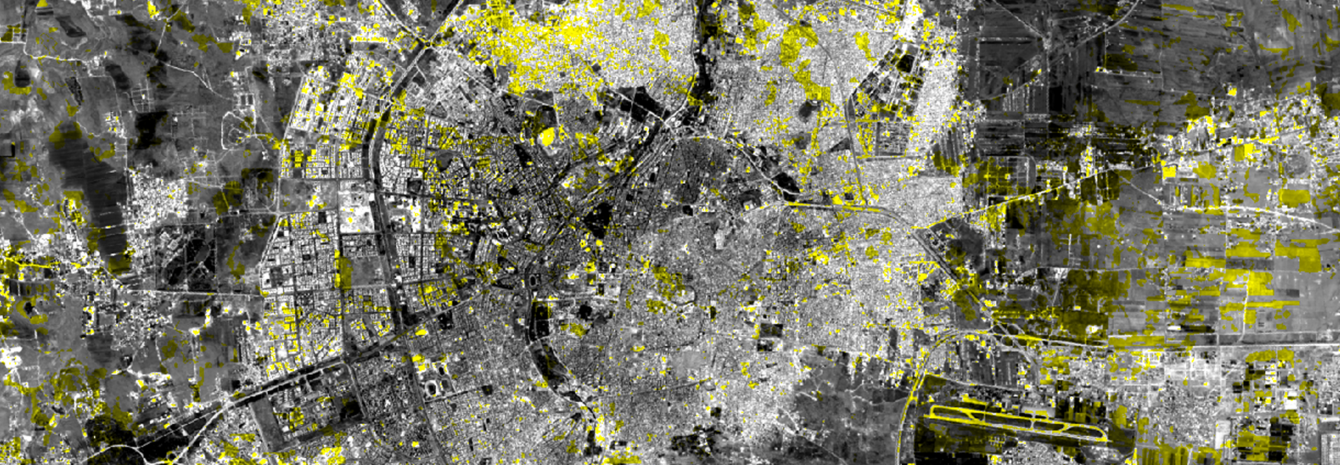
Laura Kurgan, associate professor at the Graduate School of Architecture, Planning, and Preservation (GSAPP), leads Conflict Urbanism: Aleppo, an evolving, interdisciplinary study of the city’s destruction in the face of the six-year civil war. Kurgan and her team at the Center for Spatial Research combine layers of high-resolution satellite images with data gathered by human rights organizations and the United Nations to keep the map up to date.
The map shows the city's physical destruction and tracks its changes caused by urban warfare. Users can navigate Aleppo at the neighborhood scale, examine geo-located data about the damage, and share their stories about what is really happening. Kurgan’s team continues to add more datasets and case studies to the project, including drone footage released by activists on the ground, that offer new perspectives on the civil war.
“A map like this is a platform for storytelling with data. Every time you put on a layer of data, it’s like adding another layer of truth, another narrative,” Kurgan said. Learn more.
Make Your Commitment Today